
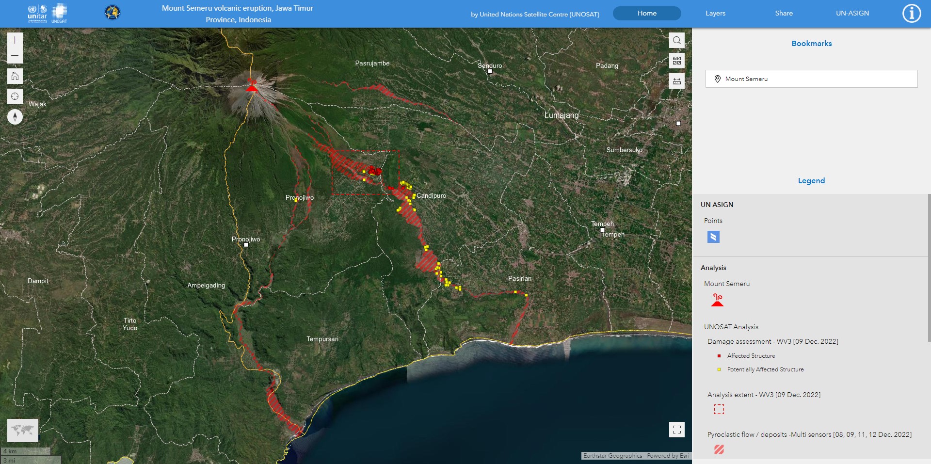
Mount Semeru volcanic eruption, Jawa Timur Province, Indonesia - UNOSAT Live Web Map


Downloads
-
hdx_bot_scrapers updated the dataset Mount Semeru volcanic eruption, Jawa Timur Province, Indonesia - UNOSAT Live Web Map
1 year ago -
hdx_dataseries_bot updated the dataset Mount Semeru volcanic eruption, Jawa Timur Province, Indonesia - UNOSAT Live Web Map
1 year ago -
hdx_bot_geopreview updated the dataset Mount Semeru volcanic eruption, Jawa Timur Province, Indonesia - UNOSAT Live Web Map
2 years ago -
2 years ago
-
VO20221206IDN_gdb.zipGeodatabase
Modified: 9 February 2023
-
VO202212006IDN_SHP.zipSHP
Modified: 9 February 2023
 Download
| Source | UN Operational Satellite Applications Programme (UNOSAT) |
|---|---|
| Contributor | United Nations Satellite Centre (UNOSAT) |
| Time Period of the Dataset [?] | December 13, 2022-December 13, 2022 ... More |
| Modified [?] | 9 February 2023 |
| Dataset Added on HDX [?] | 9 February 2023 Less |
| Expected Update Frequency | Never |
| Location | |
| Visibility |
Public
|
| License | Creative Commons Attribution Share-Alike |
| Methodology | |
| Caveats / Comments | |
| Tags | |
| File Format |