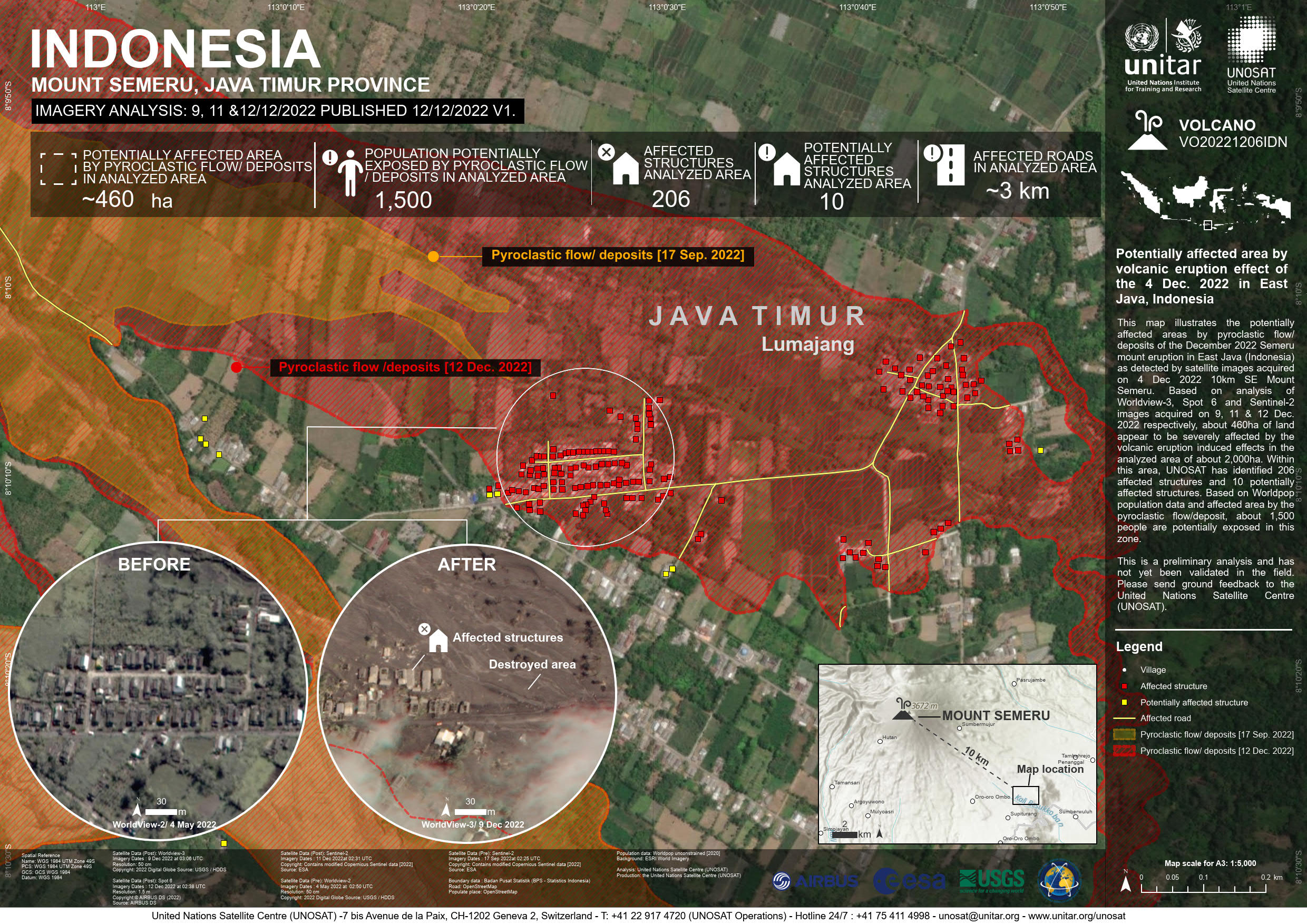
UNOSAT code VO20221206IDN, GDACS Id: 1000057 This map illustrates the potentially affected areas by pyroclastic flow/deposits of the December 2022 Semeru mount eruption in East Java (Indonesia) as detected by satellite images acquired on 4 Dec 2022 10km SE Mount Semeru. Based on analysis of Worldview-3, Spot 6 and Sentinel-2 images acquired on 9, 11 & 12 Dec. 2022 respectively, about 460ha of land appear to be severely affected by the volcanic eruption induced effects in the analyzed area of about 2,000ha. Within this area, UNOSAT has identified 206 affected structures and 10 potentially affected structures. Based on Worldpop population data and affected area by the pyroclastic flow/deposit, about 1,500 people are potentially exposed in this zone.
This is a preliminary analysis and has not yet been validated in the field. Please send ground feedback to the United Nations Satellite Centre (UNOSAT).