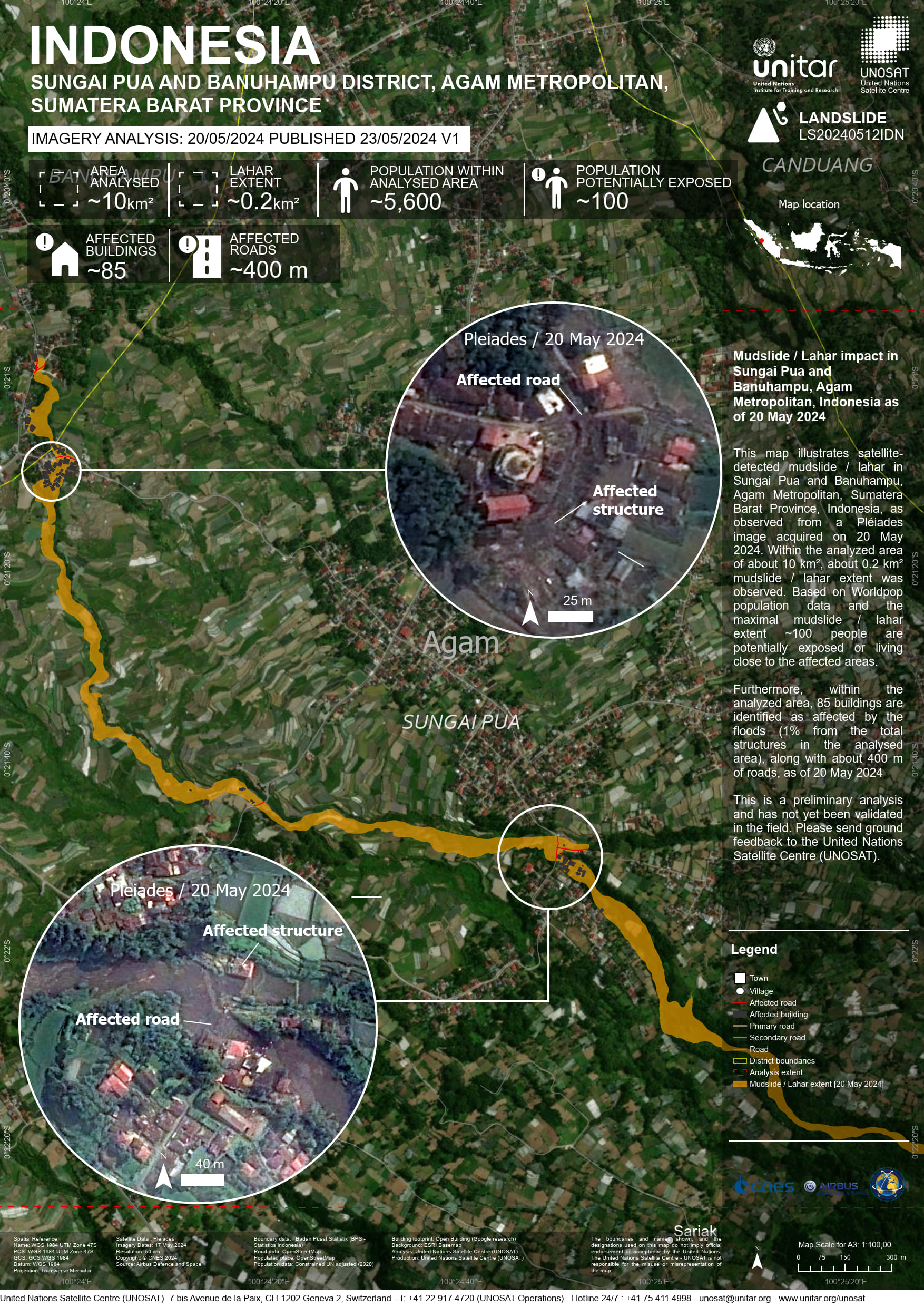
UNOSAT code: LS20240512IDN, GDACS ID: 1102617 This map illustrates satellite-detected mudslide / lahar in Sungai Pua and Banuhampu, Agam Metropolitan, Sumatera Barat Province, Indonesia, as observed from a Pléiades image acquired on 20 May 2024. Within the analyzed area of about 1,000 ha about 200 ha mudslide / lahar extent was observed. Based on Worldpop population data ~ 5,000 people within the analysed areas.
Furthermore, within the analyzed area, 85 buildings are identified as affected by the floods (1% of the total structures in the analysed area), along with about 400 m of roads, as of 20 May 2024
This is a preliminary analysis and has not yet been validated in the field. Please send ground feedback to the United Nations Satellite Centre (UNOSAT).