

-
Time Period of the Dataset [?]: November 01, 2023-November 01, 2023 ... MoreModified [?]: 1 November 2023Dataset Added on HDX [?]: 2 November 2023This dataset updates: Never
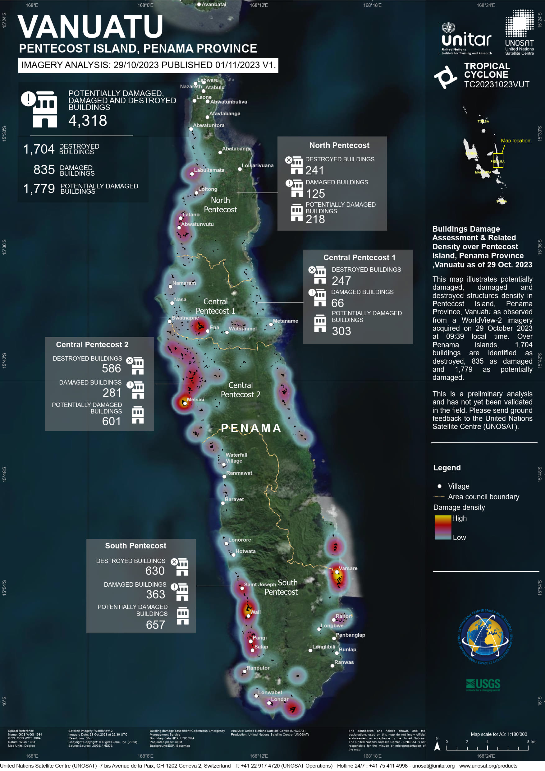
WMap Link
Click to go to showcase
Click to go to showcase