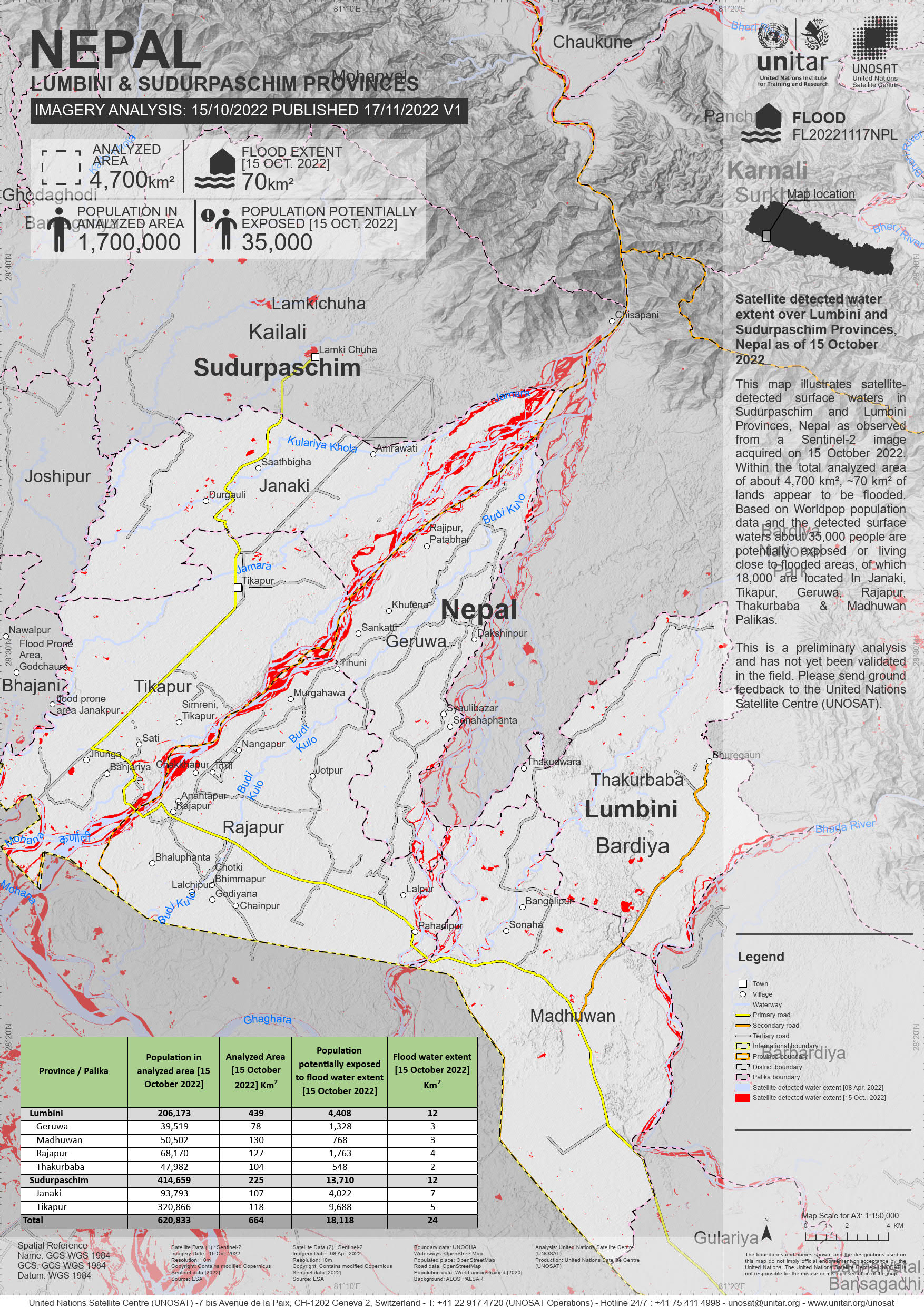
UNOSAT code FL20221117NPL This map illustrates satellite-detected surface waters in Sudurpaschim and Lumbini Provinces, Nepal as observed from a Sentinel-2 image acquired on 15 October 2022. Within the total analyzed area of about 4,700 km², ~70 km² of lands appear to be flooded. Based on Worldpop population data and the detected surface waters about 35,000 people are potentially exposed or living close to flooded areas, of which 18,000 are located In Janaki, Tikapur, Geruwa, Rajapur, Thakurbaba & Madhuwan Palikas.
This is a preliminary analysis and has not yet been validated in the field. Please send ground feedback to the United Nations Satellite Centre (UNOSAT).